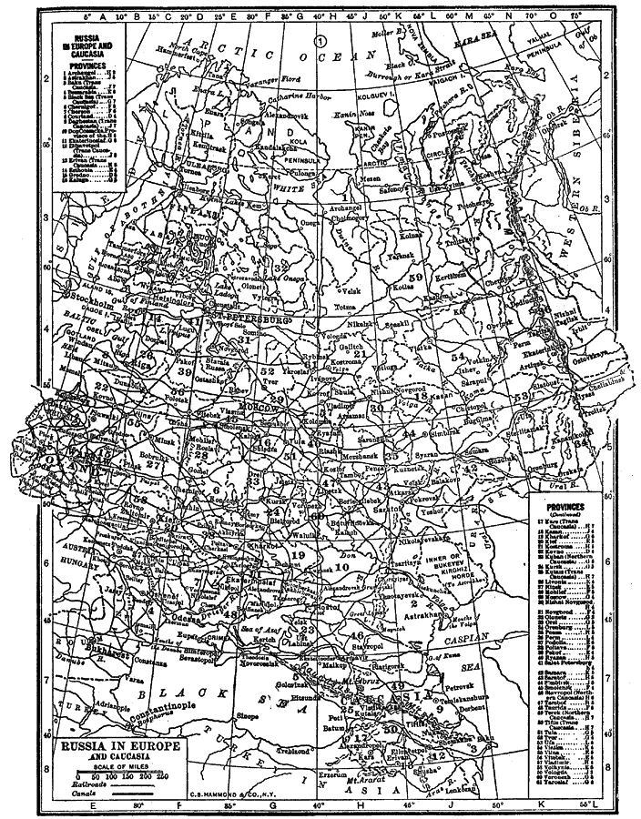
Description: A black–and–white map of European Russia in 1912, showing the Russian provinces, major cities, railways, canals, rivers, and mountain systems. The map has a grid–reference key for the provinces.
Place Names: Eastern Europe, Russia, �St. Petersburg, �Moscow, �Black Se
ISO Topic Categories: boundaries,
inlandWaters,
transportation,
oceans
Keywords: Russia in Europe and Caucasia, physical, �political, �transportation, physical features,
topographical, major political subdivisions, railroads,
water routes, boundaries,
inlandWaters,
transportation,
oceans, Unknown, 1912
Source: The Manitoba Free Press, The Free Press Almanac Encyclopedia and Atlas (New York, NY: C. S. Hammond & Co., 1912) 125
Map Credit: Courtesy the private collection of Roy Winkelman |
|