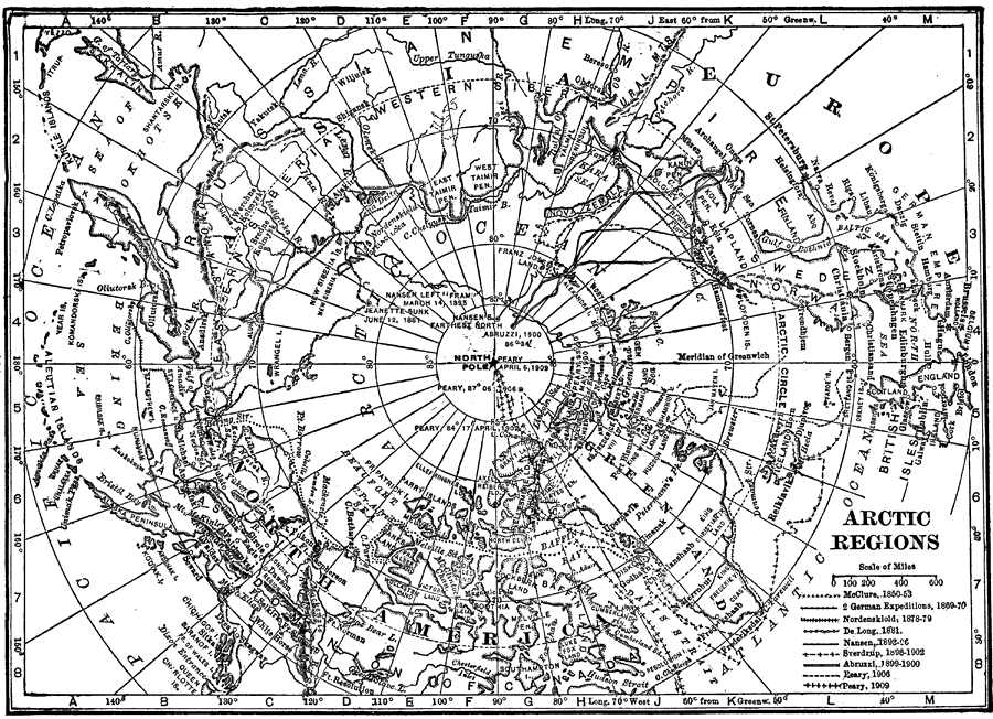
Description: A map of the North Polar Region from 1912 showing the routes of expeditions from 1850–1909 including the site of the sinking of the Jeanette, the route and date that Peary first reached the North Pole (April 6, 1909), and the routes of McClure (1850–1853), the German expeditions of 1869–1870, Nordenskiold (1878–1879), De Long (1881), Nansen (1893–1896), Sverdrup (1898–1902), Abruzzi (1899–1900), and the Peary expeditions of 1902 and 1906.
Place Names: Arctic Region, Arctic Ocean, �North Pole, �Greenland, �Siberi
ISO Topic Categories: boundaries,
oceans,
inlandWaters
Keywords: Exploration of the Arctic Regions, historical, �physical, �political, physical features, country borders, boundaries,
oceans,
inlandWaters, Unknown, 1912
Source: The Manitoba Free Press, The Free Press Almanac Encyclopedia and Atlas (New York, NY: C. S. Hammond & Co., 1912) 126
Map Credit: Courtesy the private collection of Roy Winkelman |
|