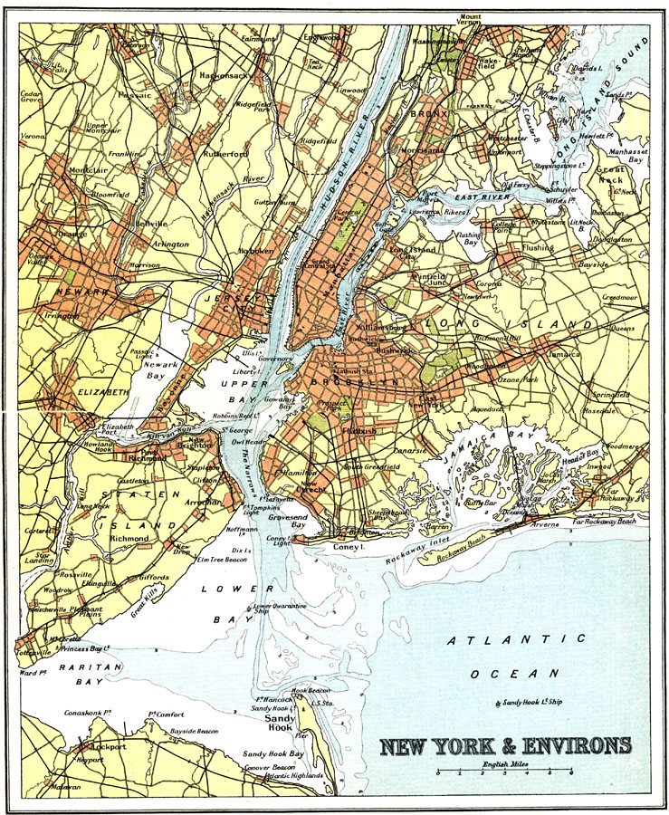
Description: New York City and it's surrounding settlements in the early twentieth century.
Place Names: Middle Atlantic States, New York, �Long Island, �Jersey City, �Newark, �Staten Island, �New York State, �New Jersey, �Middle Atlantic States, �Mid-Atlantic State
ISO Topic Categories: society
Keywords: New York City and Environs, transportation, �political, local jurisdictions, roads,
railroads, society, Unknown, 1911
Source: Ernest Rhys, Ed., A Literary and Historical Atlas of North & South America (New York, NY: E.P. Dutton & CO., 1911) 60
Map Credit: Courtesy the private collection of Roy Winkelman |
|