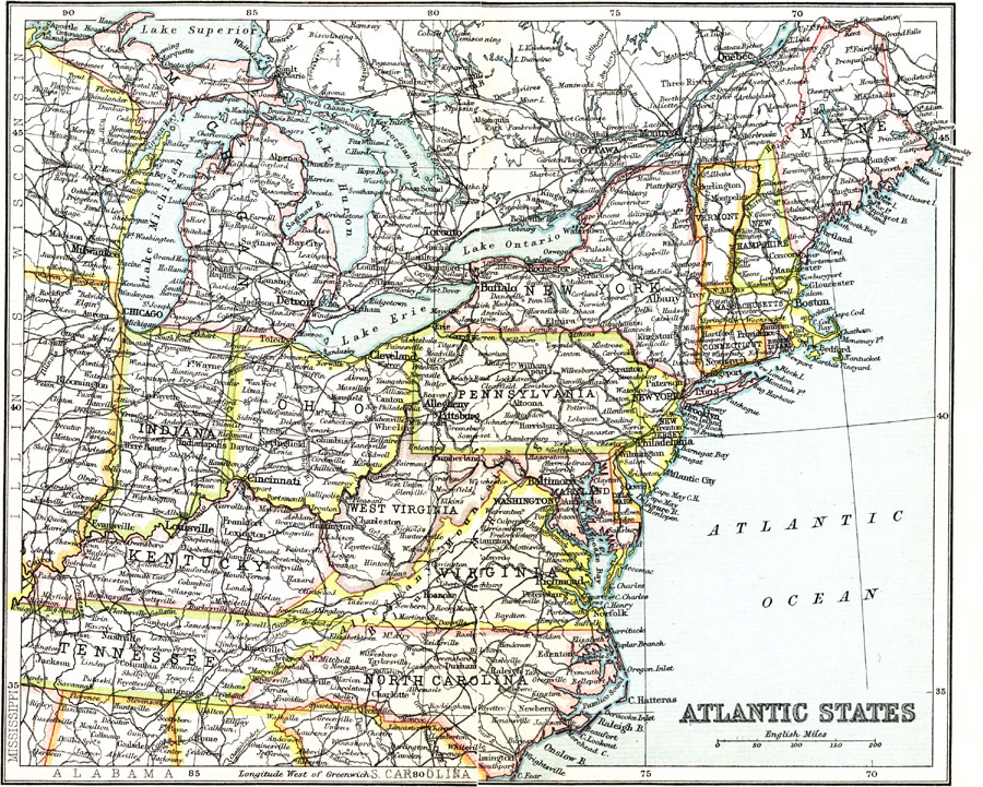
Description: A map from 1911 of the Atlantic States showing major cities, towns, ports, railroads, lakes, rivers, and coastal features of the region.
Place Names: Eastern States, New York, �Boston, �Virginia, �Tennessee, �West Virginia, �Ohio, �Indiana, �Kentucky, �Pennsylvania, �New Jersey, �Vermont, �New Hampshire, �Massachusetts, �Maine, �Rhode Island, �Atlantic State
ISO Topic Categories: society
Keywords: Atlantic States, political, �transportation, major political subdivisions, railroads, society, Unknown, 1911
Source: Ernest Rhys, Ed., A Literary and Historical Atlas of North & South America (New York, NY: E.P. Dutton & CO., 1911) 64
Map Credit: Courtesy the private collection of Roy Winkelman |
|