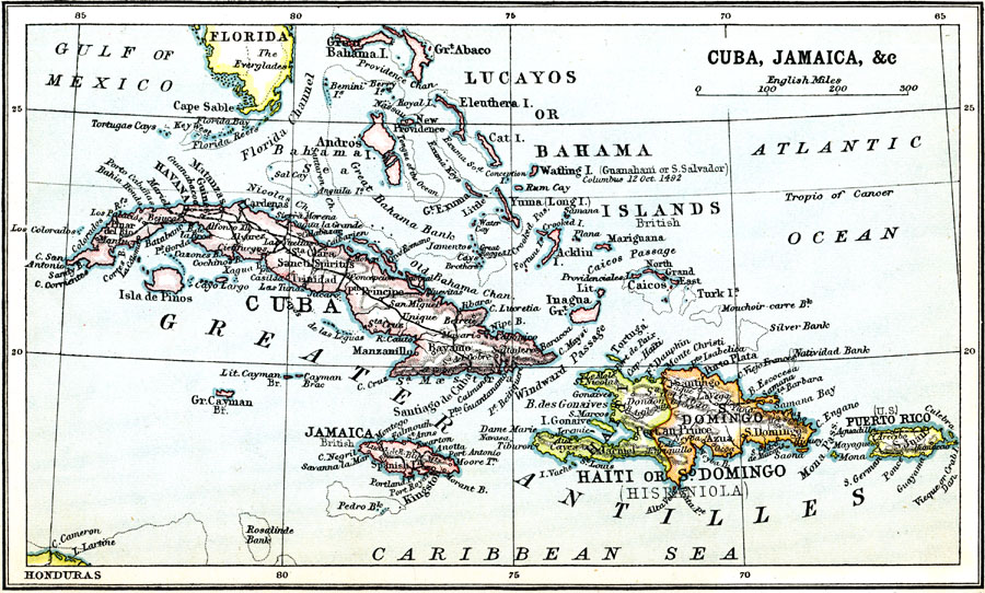
Description: A map from 1911 of the Greater Antilles (Cuba, Jamaica, Hispaniola, and Puerto Rico), and the Lucayos or Bahama Island group. The map shows foreign possession at the time, capitals, major cities, and ports, railroads, terrain, rivers, coastal features, banks, and smaller islands. This map shows the landing site of Columbus on Watling (Guanahani or San Salvador) Island.
Place Names: A Regional Map of North America, Cuba, �Jamaica, �Bahama, �Lucayos, �Haiti, �Puerto Ric
ISO Topic Categories: society
Keywords: Cuba and Jamaica, physical, �political, kCaribbean, physical features,
topographical, country borders, society, Unknown, 1911
Source: Ernest Rhys, Ed., A Literary and Historical Atlas of North & South America (New York, NY: E.P. Dutton & CO., 1911) 80
Map Credit: Courtesy the private collection of Roy Winkelman |
|