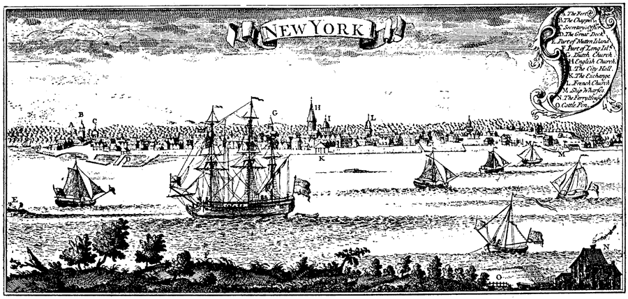
Description: Landmarks of New York City in 1746. The legend is as follows: (A) The Fort; (B) The Chapel; (C) Secretary's office; (D) The Great Dock; (E) Port of Nutten Island; (F) Port of Long Island; (G) Dutch Church; (H) English Church; (I) The City Hall; (K) The Exchange; (L) French Church; (M) Ship Wharfes; (N) The Ferry House; and (O) Cattle Pen.
Place Names: New York, New York Cit
ISO Topic Categories: society
Keywords: New York City, historical, �transportation, society, Unknown, 1746
Source: Ernest Rhys, Ed., A Literary and Historical Atlas of North & South America (New York, NY: E.P. Dutton & CO., 1911) 129
Map Credit: Courtesy the private collection of Roy Winkelman |
|