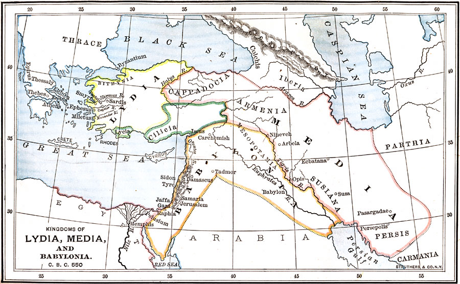
Description: A map of the kingdoms of Lydia, Media, and Babylonia at the time of Cyrus the Great (558–529 BC). The map shows the territories of Lydia (including Bithynia), Lycia, and Cilicia in Asia Minor, the territories of Media, including Cappadocia, Armenia, Susiana, and Persis, and the territory of Babylonia from the Persian Gulf through Mesopotamia, and west to the Mediterranean coast. Important rivers and historical cities are shown in the region, including those in Greece and Egypt. Persian King Cyrus the Great created a Persian Empire that included all three of these kingdoms. "Through his energy and soldiery genius, he soon built up an empire more extended than any over which the scepter had yet been swayed by an Oriental monarch, or indeed, so far as we know, by any ruler before his time. It stretched from the Indus to the Persian gulf, thus embracing not only the territories of the Median kingdom, but also those of the allied kingdoms of Lydia and Babylonia." — Myers, 1896
Place Names: Southwest Asia, Lydia, �Media, �Babylonia, �Armenia, �Cilici
ISO Topic Categories: boundaries,
inlandWaters,
oceans
Keywords: Kingdoms of Lydia, Media, and Babylonia, physical, �political, �historical, physical features,
topographical, country borders, boundaries,
inlandWaters,
oceans, Unknown, 550 BC
Source: P. V. N. Myers, A General History for Colleges and High Schools (Boston, MA: Ginn & Company, 1896) 74
Map Credit: Courtesy the private collection of Roy Winkelman |
|