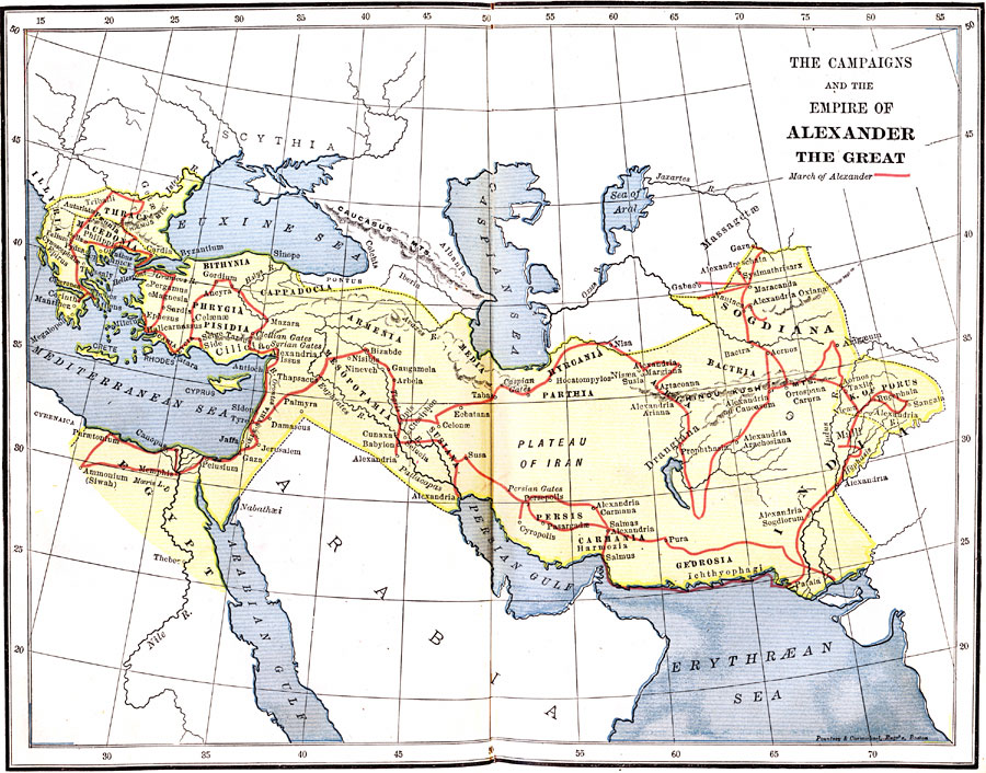
Description: A map showing the Empire and the march of Alexander the Great. Also shows the cities that became part of the empire.
Place Names: Regional Miscellaneous, Euxine Sea, �Mediterranean Sea, �Arabian Gulf, �Persian Gulf, �Erythr&Aelig;an Sea, �Sogdiana, �Phrygia, �Pisidia, �Cappadocia, �Bithynia, �Thrace, �Macedonia, �Persis, �Medi
ISO Topic Categories: physical, �historical, kWorldMedSea, kWorldAfroAsia, kWorldEurasia
Keywords: The Campaigns and the Empire of Alexander the Great, physical, �historical, physical features,
topographical, physical, �historical, kWorldMedSea, kWorldAfroAsia, kWorldEurasia, Unknown, 334–326 BC
Source: P. V. N. Myers, A General History for Colleges and High Schools (Boston, MA: Ginn & Company, 1896) 162
Map Credit: Courtesy the private collection of Roy Winkelman |
|