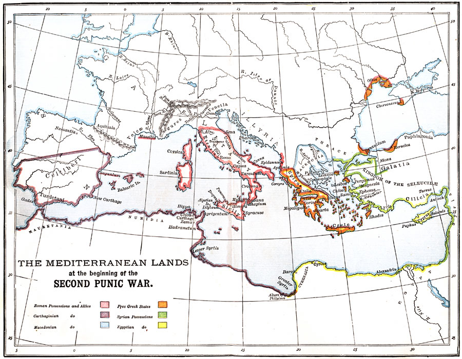
Description: A map of the Mediterranean region at the beginning of the Second Punic War showing the Roman possessions and allies, Carthaginian areas, Macedonian areas, Free Greek States, Syrian possessions, and Egyptian areas.
Place Names: Regional Mediterranean, Celtiberi, �Itally, �Epiros, �Macedonia, �Galatia, �Mauretania, �Numidia, �Thrace, �Sicil
ISO Topic Categories: physical, �political, kWorldMedSea
Keywords: The Mediterranean Lands at the beginning of the Second Punic War, physical, �political, physical features,
topographical, country borders, physical, �political, kWorldMedSea, Unknown, 218 BC
Source: P. V. N. Myers, A General History for Colleges and High Schools (Boston, MA: Ginn & Company, 1896) 254
Map Credit: Courtesy the private collection of Roy Winkelman |
|