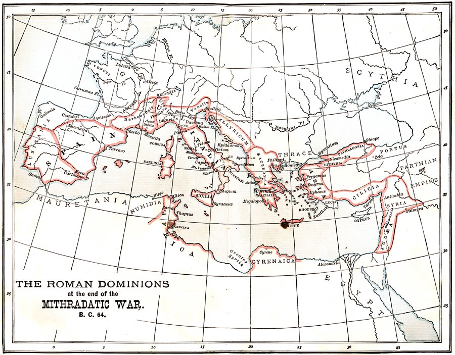
Description: A map of the Mediterranean region showing the Roman Dominions at the end of he Mithradatic War. The Roman general Sulla led the campaign against Mithradates. "When Sulla left Italy with his legions for the East, he knew very well that his enemies would have their own way in Italy during his absence; but he also knew that, if successful in his campaign against Mithridates, he could easily regain Italy, and wrest the government form the hands of the Marian party. We can here take space to give simply the results of Sulla's campaigns in the East. After driving the army of Mithridates out of Greece, Sulla crossed the Hellespont, and forced the king to sue for peace. He gave up his conquered territory, surrendered his war ships, and paid a large indemnity to cover the expenses of the war." —Myers, 1896
Place Names: Regional Mediterranean, Spain, �Italy, �Macedonia, �Cilicia, �Judea, �Syria, �Cyrenaica, �Numidia, �Mauretania, �Gaul, �Illyricum,
ISO Topic Categories: physical, �political, �historical, kWorldMedSea, kWorldAfroAsia, kWorldEurasia, kWorldEuroAfrica
Keywords: The Roman Dominions at the end of the Mithradatic War, physical, �political, �historical, physical features,
topographical, country borders,
major political subdivisions, physical, �political, �historical, kWorldMedSea, kWorldAfroAsia, kWorldEurasia, kWorldEuroAfrica, Unknown, 64 BC
Source: P. V. N. Myers, A General History for Colleges and High Schools (Boston, MA: Ginn & Company, 1896) 282
Map Credit: Courtesy the private collection of Roy Winkelman |
|