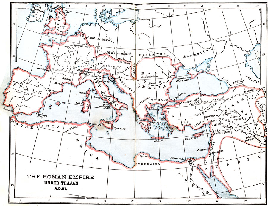
Description: A map of the Roman Empire under Trajan's rule showing the boundaries of the Empire. "Trajan was a native of Spain, and a soldier by profession and talent. His ambition to achieve military renown led him to undertake distant and important conquests. It was the policy of Augustus — a policy adopted by most of his successors — to make the Danube in Europe and the Euphrates in Asia the limits of the Roman empire in those respective quarters. But Trajan determined to push the frontiers of his dominions beyond both these rives, scorning to permit Nature by these barriers to mark out the confines of roman sovereignty. He crossed the Danube by means of a bridge, the foundations of which may still be seen, and subjugated the bold and warlike Dacian tribes lying behind that stream — tribes that had often threatened the peace of the empire. After celebrating his victories in a magnificent triumph at Rome, Trajan turned to the East, led his legions across the Euphrates, reduced Armenia, and wrested from the Parthians most of the territory which anciently formed the heart of the Assyrian monarchy. To Trajan belongs the distinction of extending the boundaries of the empire to the most distant points to which Roman ambition and prowess were ever able to push them." —Myers, 1896
Place Names: Regional Mediterranean, Europe, �Africa, �Asia, �Spain, �Italy, �Gaul, �Britain, �Dacia, �Mauretani
ISO Topic Categories: physical, �political, �historical, kWorldMedSea, kWorldAfroAsia, kWorldEurasia, kWorldEuroAfrica
Keywords: The Roman Empire Under Trajan, physical, �political, �historical, physical features, country borders,
major political subdivisions, physical, �political, �historical, kWorldMedSea, kWorldAfroAsia, kWorldEurasia, kWorldEuroAfrica, Unknown, AD 117
Source: P. V. N. Myers, A General History for Colleges and High Schools (Boston, MA: Ginn & Company, 1896) 318
Map Credit: Courtesy the private collection of Roy Winkelman |
|