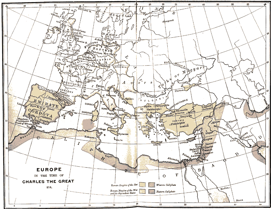
Description: A map of Europe and surrounding areas of Asia and Africa during the time of Charles the Great, king of the Franks, also known as Charlemagne. Shows the Roman Empire of the East, the Roman Empire of the West and its dependent States, the Western Caliphate, and the Eastern Caliphate. Also shows the location of the Scots, English, Britons, Swedes, Saxons, Avars, Turks, and Danes.
Place Names: Regional Miscellaneous, Africa, �Asia, �Europe, �Emirate of Cordova, �Caliphate of Bagdad, �Roman Empire, �Italy, �Francia, �Phrygia,
ISO Topic Categories: physical, �political, �historical, kWorldMedSea, kWorldAfroAsia, kWorldEurasia, kWorldEuroAfrica
Keywords: Europe in the Time of Charles the Great, physical, �political, �historical, physical features, country borders, physical, �political, �historical, kWorldMedSea, kWorldAfroAsia, kWorldEurasia, kWorldEuroAfrica, Unknown, A.D. 814
Source: P. V. N. Myers, A General History for Colleges and High Schools (Boston, MA: Ginn & Company, 1896) 404
Map Credit: Courtesy the private collection of Roy Winkelman |
|