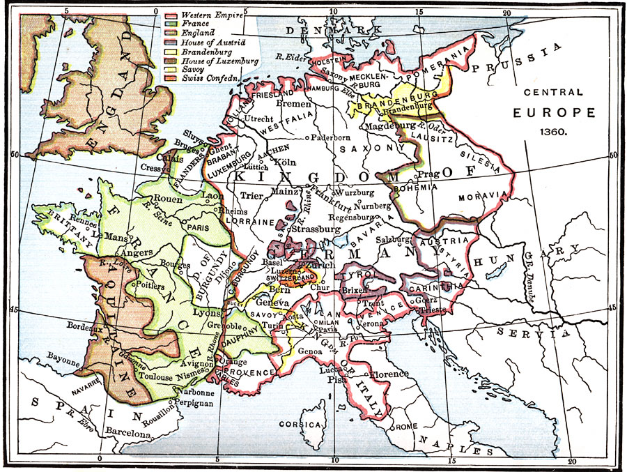
Description: A map of the Western and Central portion of Europe at the end of the Edwardian War (first phase of the Hundred Year's War) and the signing of the Treaty of Brétigny. The map is color–coded to show the Western Empire, France, England, the House of Austrid, Brandenburg, the House of Luxemburg, Savoy, and the Swiss Confederacy.
Place Names: Western and Central Europe, France, �Spain, �England, �Kingdom of Germany, �Aquitaine, �Prussia, �Brittany, �Flanders, �Burgundy, �Western Empire, �House of Austrid, �Brandenburg, �House of Luxemburg, �Savoy, �Swiss Confederacy,
ISO Topic Categories: boundaries,
inlandWaters,
oceans
Keywords: Western and Central Europe at the end of the Edwardian War, physical, �political, �historical, kHundredYearsWar, physical features, country borders, boundaries,
inlandWaters,
oceans, Unknown, 1360
Source: P. V. N. Myers, A General History for Colleges and High Schools (Boston, MA: Ginn & Company, 1896) 506
Map Credit: Courtesy the private collection of Roy Winkelman |
|