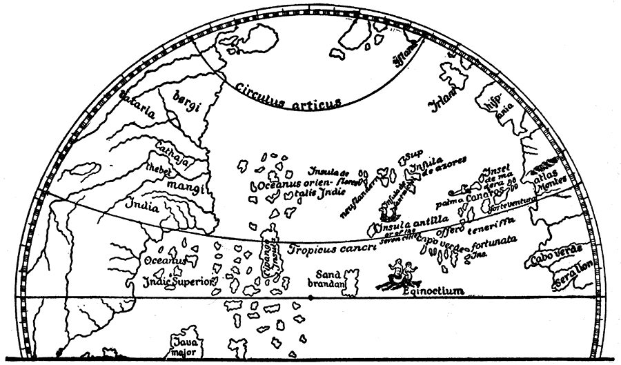
Description: From the globe of Martin Behaim. Map of the ocean that was thought to lie between the west coast of Europe and the East Coast of Asia. This map was created shortly before Christopher Columbus discovered the continent of North America. China is labeled as Cathaja, and Japan is labeled as Cipango.
Place Names: Regional Atlantic Ocean, China, �India, �Japan,
ISO Topic Categories: physical, �historical, kWorldAtlantic, kWorldPacific
Keywords: The Ocean and Islands Between Western Europe and Eastern Asia, physical, �historical, physical features, physical, �historical, kWorldAtlantic, kWorldPacific, Unknown, 1492
Source: P. V. N. Myers, A General History for Colleges and High Schools (Boston, MA: Ginn & Company, 1896) 514
Map Credit: Courtesy the private collection of Roy Winkelman |
|