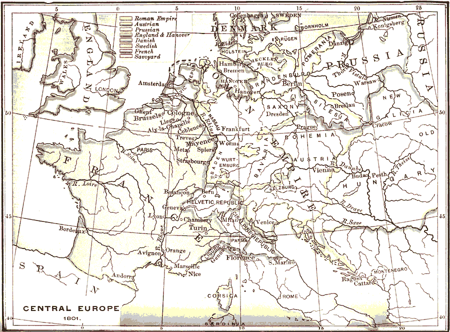
Description: A map of central Europe showing the Roman Empire, and England and Hanover. Also shows the areas under the rule of Austria, Prussia, Denmark, Sweden, and France. Wars of the First Consul. — Neither Austria nor England would acknowledge the government of the First consul as legitimate. In their view he was simply an upstart, a fortunate usurper. The throne of France belonged, by virtue of divine right, to the House of Bourbon. Napoleon mustered his soldiers. His plan was to deal Austria, his worst continental enemy, a double blow. A large army was collected on the Rhine, for an invasion of Germany. This was entrusted to Moreau. Another, intended to operate against the Austrians in Italy, was gathered at the foot of the Alps. Napoleon himself assumed command of this latter force. In the spring of the year 1800 Napoleon made his memorable passage of the Alps, and astonished the Austrian generals by suddenly appearing, with an army of 40,000 men, on the plains of Italy. Upon the renowned field of Marengo the Austrian army, which outnumbered that of the French three to one, was completely overwhelmed, and Italy lay for a second time at the feet of Napoleon (June 14, 1800)." —Myers, 1896
Place Names: Western and Central Europe, France, �Spain, �England, �Denmark, �Roman Empire, �Prussia, �Hungary, �Ireland, �Helvetic Republic,
ISO Topic Categories: boundaries,
inlandWaters,
oceans
Keywords: Central Europe, physical, �political, �historical, kNapoleonBonaparte, physical features, country borders, boundaries,
inlandWaters,
oceans, Unknown, 1801
Source: P. V. N. Myers, A General History for Colleges and High Schools (Boston, MA: Ginn & Company, 1896) 674
Map Credit: Courtesy the private collection of Roy Winkelman |
|