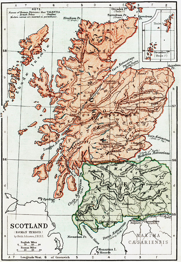
Description: A map of Scotland during the Roman Period (43 BC to AD 410). Roman names are in Latin, with modern names in parentheses. Shows roads, major cities of the time, major river ways, topography, oceans. The scale is shown in both English and Roman Miles. There is an insert of Orcades 1æ (Thule).
Place Names: United Kingdom, Carbantorigum, �Uxelum, �Vanduria, �Theodosia, �Vallum Adriani, �Caledonia, �Valentia, ��Picts Wall, �Tuva River, �Grampus Mons, �Deva River, �Clota &Aelig;stuarium, �Furth of Clyde, �Ituna &Aelig;stuarium, �Solway of Firth, �Bodotria &Aelig;stuarium,
ISO Topic Categories: elevation,
boundaries,
inlandWaters,
oceans,
transportation
Keywords: Scotland during the Roman Period, physical, �political, �transportation, �historical, physical features,
topographical, country borders,
major political subdivisions, roads,
water routes, elevation,
boundaries,
inlandWaters,
oceans,
transportation, Unknown, 43 BC to AD 410
Source: Keith Johnston, The Half-Crown Atlas of British History (Edinburgh, Scotland: W. & A. K. Johnston, 1871) 2
Map Credit: Courtesy the private collection of Roy Winkelman |
|