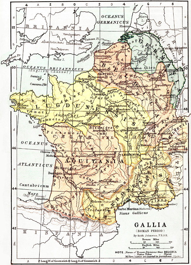
Description: Map of France and Germania under the Roman Empire. Roman names are in Latin, with modern names in parentheses. Shows major cities of the time, major river ways, topography, oceans. The scale is shown in both English and Roman Miles.
Place Names: France, Paris, �Vienna, �Tolosa, �Toulouse, �Pyrenæi Montes, �Massilia, �Marseilles, �Rhenus River, �Rhine River, �Germania, ��Mare, �Bay of Biscay, �Liger River, �Loire River, �Mosa River, �Lake Lemanus, �Alpes Penninæ, �Narbo Maritus, �Narbonne,
ISO Topic Categories:
Keywords: France and Germania during the Roman Period, physical, �political, �historical, physical features,
topographical, country borders,
major political subdivisions, water routes, Unknown, 44 B.C to A.D. 410
Source: Keith Johnston, The Half-Crown Atlas of British History (Edinburgh, Scotland: W. & A. K. Johnston, 1871) 3
Map Credit: Courtesy the private collection of Roy Winkelman |
|