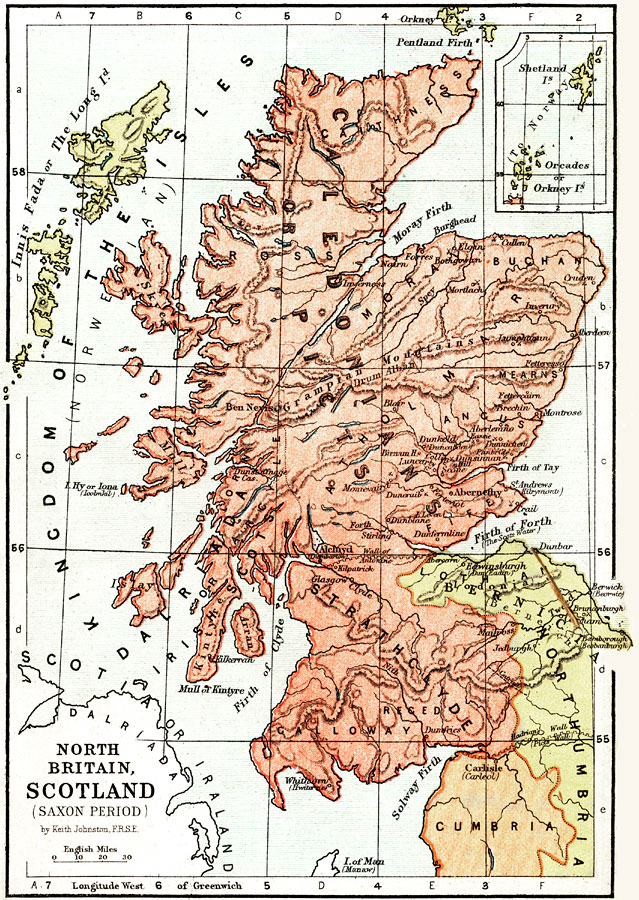
Description: A map of Scotland and North Britain during the Saxon Period from around AD 450 to the beginning of the Norman Conquest in 1066. This map shows major cities of the time, major river ways, topography, battlefields, and political boundaries. Scale in English miles. There is an insert of the Shetland Isles and the Orcades (Orkney Isles).
Place Names: United Kingdom, Kingdom of the Isles, �Shetland Isles, �Orcades, �Orkeny Isles, �Innis Fada, �The Long Isles, �Galloway, �Forth Stirling River, �Grampian Mountains, �Caledonians, �Picts, �Moray Firth, �The Scots Water, �Firth of Forth, �Cumbria, �Edinborough, �Abernet
ISO Topic Categories: boundaries,
elevation,
inlandWaters
Keywords: Scotland and Northern England during the Saxon Period, physical, �political, �transportation, �historical, physical features,
topographical, country borders,
major political subdivisions, water routes, boundaries,
elevation,
inlandWaters, Unknown, AD 450–1066
Source: Keith Johnston, The Half-Crown Atlas of British History (Edinburgh, Scotland: W. & A. K. Johnston, 1871) 5
Map Credit: Courtesy the private collection of Roy Winkelman |
|