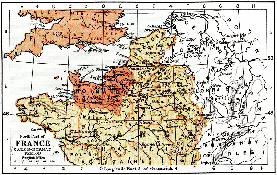
Description: Map of Northern France, Southern England during the Saxon–Norman Period. Shows major cities of the time, major river ways, topography, political boundaries. Scale in English miles.
Place Names: France, Normandy, �Le Mans River, �Brittany, �Champagne, �Flanders, �Seine River, �Loire River, �Bourges, �Mantes, �Maine, �Mayenne, �Caen, �Royal Domain, ��Pari
ISO Topic Categories: transportation,
inlandWaters,
elevation,
boundaries
Keywords: Northern France, Southern England during the Saxon-Norman Period, physical, �political, �transportation, �historical, physical features,
topographical, country borders,
major political subdivisions, water routes, transportation,
inlandWaters,
elevation,
boundaries, Unknown, AD 450 to 1400
Source: Keith Johnston, The Half-Crown Atlas of British History (Edinburgh, Scotland: W. & A. K. Johnston, 1871) 6
Map Credit: Courtesy the private collection of Roy Winkelman |
|