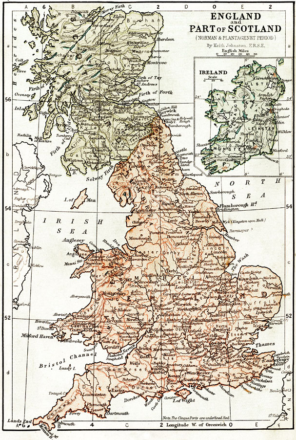
Description: Map of England, part of Scotland and Ireland during the Norman and Plantagenet Period. Shows major cities of the time, major river ways, topography, political boundaries. Scale in English miles. Insert of Ireland in right upper corner of map, can match up with outline of Ireland on far left side of map.
Place Names: United Kingdom, Dublin, �Limerick, �Aberdeen, �Firth of Lorn, �Moray Firth, �Montrose, �Firth of Forth, �Berwick, �Scotland, �England, �Ireland, �North Sea, �Irish Sea, �Bristoll Channel, �River Thames, �Lancaster, �The Marches, �York, �The Wash, �Cambridge, �Manchest
ISO Topic Categories: boundaries,
elevation,
inlandWaters,
oceans,
transportation
Keywords: England, part of Scotland and Ireland during the Norman and Plantagenet Period, physical, �political, �transportation, �historical, physical features,
topographical, country borders,
major political subdivisions, water routes, boundaries,
elevation,
inlandWaters,
oceans,
transportation, Unknown, 1067–1509
Source: Keith Johnston, The Half-Crown Atlas of British History (Edinburgh, Scotland: W. & A. K. Johnston, 1871) 7
Map Credit: Courtesy the private collection of Roy Winkelman |
|