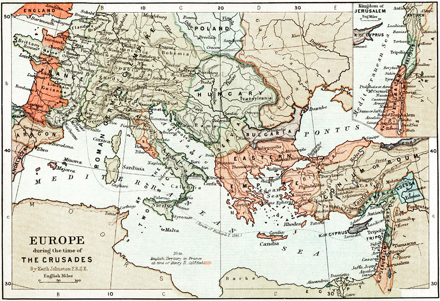
Description: A map of Europe during the time of The Crusades, including parts of Asia Minor and Palestine. The map shows principal cities of the time, major river ways, topography, and political boundaries. The map scale in English miles. The map displays the route of Richard I in 1191, the British territories in France under the rule of Henery II, and the Eastern Empire. The insert map details the Kingdom of Jerusalem, and includes Jordon, Tripolis, and Antioch.
Place Names: Western and Central Europe, France, �Poland, �Aragon, �Normandy, �England, �Roman Germanic Empire, �Rome, �Two Sicllies, �Malta, �Mediterranean Sea, �London, �Paris, �Florence, �Frankfurt, �Hungary, �Servia, �Bulgaria, �Eastern Empire, �Iconium, �Roum, �Armenia, �Edessa, �Cyprus,
ISO Topic Categories: boundaries,
elevation,
inlandWaters,
oceans,
transportation
Keywords: Europe during the time of The Crusades, physical, �political, �transportation, �historical, kCrusades, physical features,
topographical, country borders,
major political subdivisions, water routes, boundaries,
elevation,
inlandWaters,
oceans,
transportation, Unknown, 1095–1291
Source: Keith Johnston, The Half-Crown Atlas of British History (Edinburgh, Scotland: W. & A. K. Johnston, 1871) 9
Map Credit: Courtesy the private collection of Roy Winkelman |
|