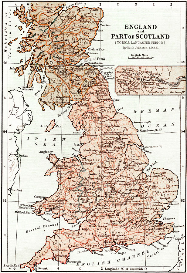
Description: Map of England and the southern part of Scotland during the War of the Roses (1453–1487) between the House of York (White Rose) and the House of Lancaster (Red Rose). This map shows major cities of the time, major river ways, topography, political boundaries, and battlefields of the war, including St. Albans, Blore Heath, Northampton, Wakefield, Towton, Hedgeley Moor, Hexham, Edgecote Moor, Barnet, Tewkesbury, Bosworth Field, and Stoke Field. Map scale in English miles. The insert is an enlarged map of the London, England area with the River Thames.
Place Names: United Kingdom, London, �River Thames, �Firth of Forth, �Irish Sea, �German Ocean, �English Channel, �Strait of Dover, �The Wash, �Isle of Man, �Cumberland, �York, �Cornwall, �Bristol, �Perth, �Dundee, �Newcastle, �Plymouth, �Edinborough, �Lynn Regis, �Kings Lynn, �Fa
ISO Topic Categories: boundaries,
elevation,
inlandWaters,
oceans
Keywords: England and Part of Scotland during the York and Lancaster period, physical, �political, �transportation, �historical, physical features,
topographical, country borders,
major political subdivisions, water routes, boundaries,
elevation,
inlandWaters,
oceans, Unknown, 1453–1487
Source: Keith Johnston, The Half-Crown Atlas of British History (Edinburgh, Scotland: W. & A. K. Johnston, 1871) 11
Map Credit: Courtesy the private collection of Roy Winkelman |
|