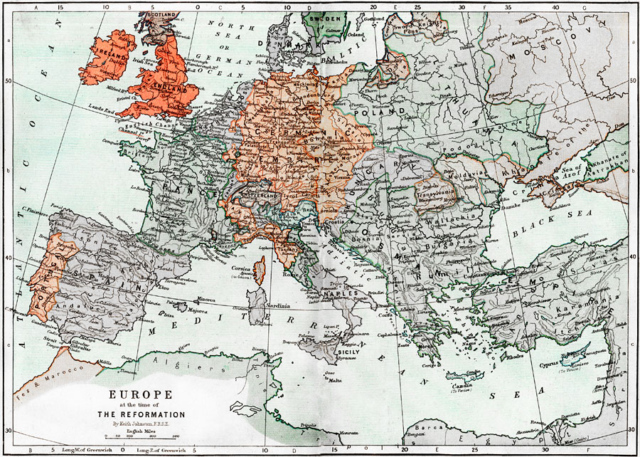
Description: Map of Europe at the time of The Protestant Reformation movement from Martin Luther in 1517 to the Peace of Westphalia in 1648. Shows major cities of the time, major river ways, topography, political boundaries. This map illustrates the reformation movements in Germany, Switzerland, Scandinavia, England, Scotland, Netherlands, Hungary, and France. Scale in English miles.
Place Names: A Complete Map of Europe, France, �Poland, �Portugal, �Spain, �Sweden, �Ireland, �Scotland, �England, �North Sea, �German Sea, �Denmark, �Baltic Sea, �Sword Knights, �Prussia, �Netherlands, �Lithuania, �Moscow, �Germanic Empire, �Switzerland, �Hungary, �Moldavia, �Transylvania,
ISO Topic Categories: boundaries,
elevation,
inlandWaters,
oceans,
transportation
Keywords: Europe at the time of The Reformation, physical, �political, �transportation, �historical, kReformation, physical features,
topographical, country borders,
major political subdivisions, water routes, boundaries,
elevation,
inlandWaters,
oceans,
transportation, Unknown, 1517–1648
Source: Keith Johnston, The Half-Crown Atlas of British History (Edinburgh, Scotland: W. & A. K. Johnston, 1871) 13, 14
Map Credit: Courtesy the private collection of Roy Winkelman |
|