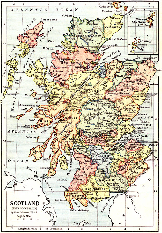
Description: This is a map of Scotland during the Brunswick Period (House of Hanover – 1714 to 1910). The map shows major cities of the time, major river ways, topography and political boundaries. Scale in English miles. There is an insert of the Shetland Isles and the Orkney Isles.
Place Names: United Kingdom, Edinborough, �Chevoit Hills, �Firth of Forth, �Lake Ness, �Dee River, �Perth, �Moray Firth, �Firth of Lorn, �Atlantic Ocean, �North Channel, �Dee River, �Don River, �Caledonian Canal, �Lake Linnhe, �Isle of Skye, �The Long Island, �Western Islands, �Tw
ISO Topic Categories: boundaries,
elevation,
inlandWaters,
oceans,
transportation
Keywords: Scotland during the Brunswick Period, physical, �political, �transportation, �historical, physical features,
topographical, country borders,
major political subdivisions, water routes, other military, boundaries,
elevation,
inlandWaters,
oceans,
transportation, Unknown, 1714–1910
Source: Keith Johnston, The Half-Crown Atlas of British History (Edinburgh, Scotland: W. & A. K. Johnston, 1871) 25
Map Credit: Courtesy the private collection of Roy Winkelman |
|