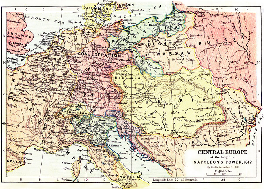
Description: A map of Central Europe at the height of Napoleon's Power, 1812. The map shows major battle sites, principal cities of the time, major river ways, topography and political boundaries. Scale in English miles.
Place Names: Western and Central Europe, Sweden, �England, �North Sea, �Spain, �The French Empire, �Confederation of the Rhine, �Prussia, �Russia, �Baltic Sea, �Duchy of Warsaw, �Austria, �Turkey, �Kingdom of Italy, �Naples, �Rome, �Paris, �Kingdom of Holland, �London, �Elbe River, �Rhine Riv
ISO Topic Categories: boundaries,
elevation,
inlandWaters,
oceans,
transportation
Keywords: Central Europe at the Height of Napoleon's Power, physical, �political, �transportation, �historical, kNapoleonBonaparte, physical features,
topographical, country borders,
major political subdivisions, water routes, other military, boundaries,
elevation,
inlandWaters,
oceans,
transportation, Unknown, 1812
Source: Keith Johnston, The Half-Crown Atlas of British History (Edinburgh, Scotland: W. & A. K. Johnston, 1871) 27
Map Credit: Courtesy the private collection of Roy Winkelman |
|