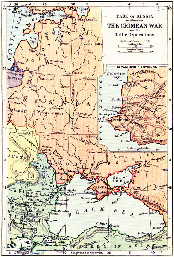
Description: A map of the region around the Black Sea at the time of the Crimean War (1853–1856), showing parts of Russia, Austria, and the Turkish Ottoman Empire in Europe (Moldavia, Wallachia, and Bulgaria) and along the Black Sea. This map shows major cities of the time, important battle sites, major river ways, topography and political boundaries. The insert map details the Crimean Peninsula, showing Sevastopol and environs, railways and roads, and important battle sites of the war. The map scale is given in English miles and Russian Versts.
Place Names: Eastern Europe, Russia, �Baltic Provinces, �Crimea, �Black Sea, �South Russia, �Turkey,, �Austria, �Poland, �Prussia, �Baltic Se
ISO Topic Categories: boundaries,
elevation,
inlandWaters,
transportation
Keywords: Part of Russia, illustrating the Crimean War and the Baltic Operations , physical, �transportation, �historical, physical features,
topographical, country borders,
major political subdivisions, water routes, other military, boundaries,
elevation,
inlandWaters,
transportation, Unknown, 1853–1856
Source: Keith Johnston, The Half-Crown Atlas of British History (Edinburgh, Scotland: W. & A. K. Johnston, 1871) 29
Map Credit: Courtesy the private collection of Roy Winkelman |
|