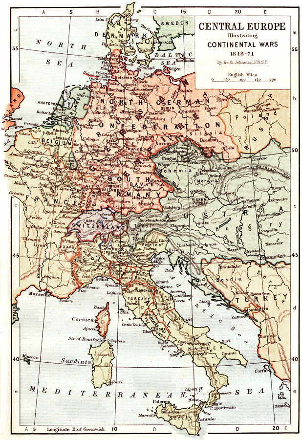
Description: A map of Central Europe illustrating the Continental Wars, 1848–71. The map shows principal cities of the time, major river ways, topography and political boundaries. Scale in English miles.
Place Names: Western and Central Europe, France, �Sweden, �Italy, �Poland, �North Sea, �Denmark, �Baltic Sea, �North German Confederation, �Austria, �Hungary, �German Empire, �South Germany, �Switzerland, �Mediterranean Sea, �Adriatic Sea, �Turkey, �Belgium, �Netherlands, �England, �Lake Cons
ISO Topic Categories: boundaries,
elevation,
inlandWaters,
transportation
Keywords: Central Europe illustrating Continental Wars, physical, �transportation, �historical, physical features,
topographical, country borders,
major political subdivisions, water routes, other military, boundaries,
elevation,
inlandWaters,
transportation, Unknown, 1848–1871
Source: Keith Johnston, The Half-Crown Atlas of British History (Edinburgh, Scotland: W. & A. K. Johnston, 1871) 30
Map Credit: Courtesy the private collection of Roy Winkelman |
|