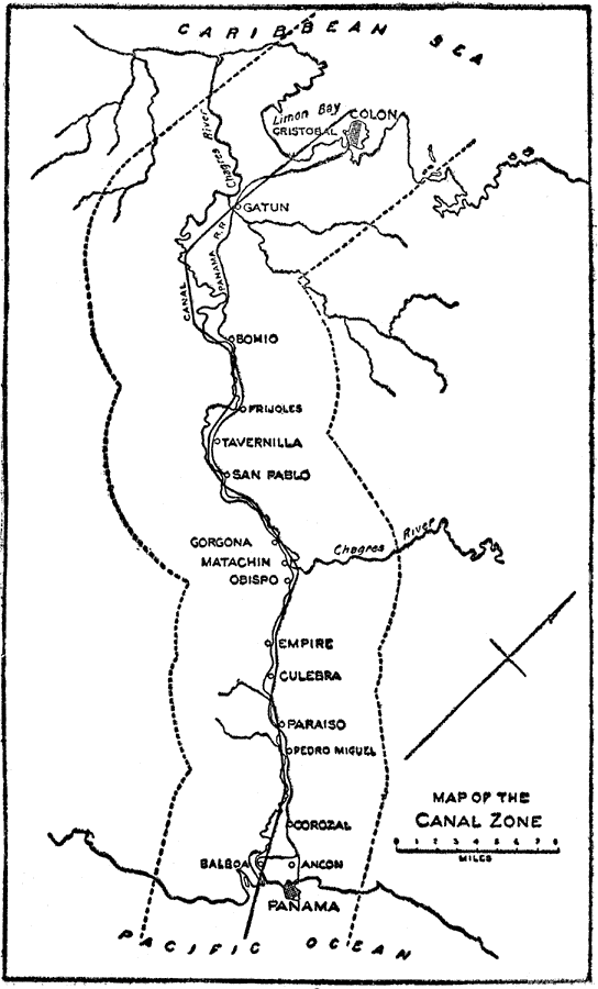
Description: A map from 1913 of the Panama Canal Zone, showing the canal route from Colon to the city of Panama, with towns along the route. The dotted lines indicate the boundary of the U.S. controlled Canal Zone. The US controlled this area from 1904 until December 31, 1999, when it was handed over to the Panama Canal Authority.
Place Names: Panama Canal Zone, Cristobal, �Colon, �Panama, �Limon Bay, �Caribbean Sea, �Gatun, �Chagres River, �Culebra, �Bomio, �Frijoles, �Tavernilla, �San Pablo, �Gorgona, �Matacin, �Obispo, �Empire, �Paraiso, �Pedro Miguel, �Corozal, �Balboa, �Ancon, �Canal Zone, �Pacific Ocean,
ISO Topic Categories: boundaries,
inlandWaters,
transportation
Keywords: The Canal Zone, physical, �political, �transportation, �historical, �canal, �physical features, country borders, water routes,
railroads, boundaries,
inlandWaters,
transportation, Unknown, 1913
Source: Logan Marshall, The Story of the Panama Canal (, : L.T. Myers, 1913) 158
Map Credit: Courtesy the private collection of Roy Winkelman |
|