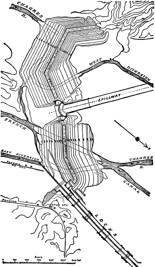
Description: A plan of the Gatun Dam, locks, and spillway on the Panama Canal. The Gatun Dam was constructed from 1907 to 1913. The plan shows the current level of the shoreline and feeding rivers (Chagres River and French Canal), the submerged water course, and depth of the excavated channel, the spillway and lock system, and the railroad line.
Place Names: Panama Canal Zone, Gatun Dam, �Gatun, �Chargres River, �Panama Canal,
ISO Topic Categories: elevation,
inlandWaters,
structure,
transportation
Keywords: Gatun Dam, Spillway and Locks, physical, �transportation, �dams, �canals,�locks, �spillways, physical features,
topographical, water routes, elevation,
inlandWaters,
structure,
transportation, Unknown, 1913
Source: Logan Marshall, The Story of the Panama Canal (, : L.T. Myers, 1913) 162
Map Credit: Courtesy the private collection of Roy Winkelman |
|