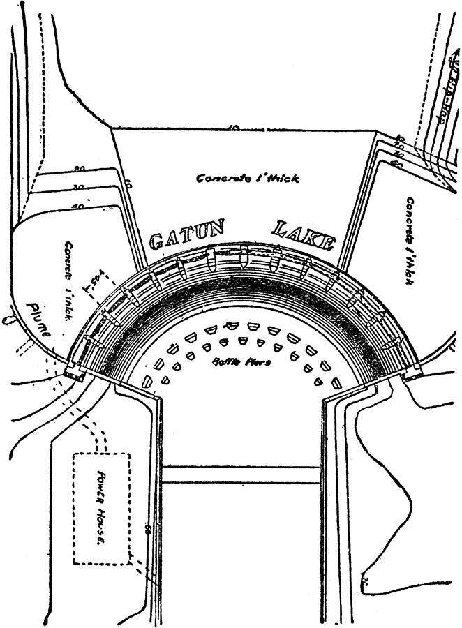
Description: A plan of the Gatun Dam spillway on the Panama Canal. The Gatun Dam was constructed from 1907 to 1913. At the time it was built, it was the largest earth dam in the world and Gatun Lake was the largest man made lake in the world.
Place Names: Panama Canal Zone, Gatun Lake, �Gatun Dam, �Panama Canal,
ISO Topic Categories: elevation,
inlandWaters,
structure,
transportation
Keywords: Gatun Dam Spillway, physical, �transportation, �canals, �dams, �spillways, �locks, �physical features, water routes, elevation,
inlandWaters,
structure,
transportation, Unknown, 1913
Source: Logan Marshall, The Story of the Panama Canal (, : L.T. Myers, 1913) 166
Map Credit: Courtesy the private collection of Roy Winkelman |
|