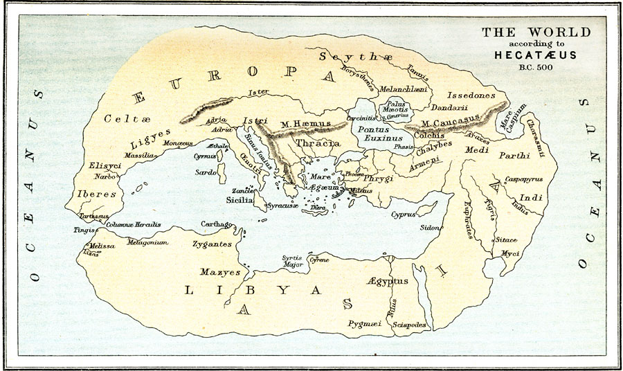
Description: A facsimile of the map of the world according to Hecatæus (500 BC), around the time of the Persian invasion of the Greek mainland, and shows the extent of early European knowledge of the earth. This map highlights the importance of navigation to the Greeks by the detail of coastline around the Mediterranean Sea and major rivers as opposed to the lack of detail for inland areas. Place names on this facsimile are Latinized, and include Pontus Euxinus (Black Sea), Sinus Ionius (Ionian Sea), Mare &Aelig;gæum (Aegean Sea), Columnæ Herculis (Gibraltar), and &Aelig;gyptus (Egypt), the rivers Nilus (Nile), Ister (Danube), Borysthenes (Dnieper), Euphrates, Tigris, and Indus, the kingdoms or territories of the Celtæ, Ligyes, Elisyci, Iberes, Zygantes, Mazyes, PygmæI, Myci, Indi, Parthi, Medi, Phrygi, Istri, and Scythæ, and the Greek settlements of Miletus (birthplace of Hecatæus), Syracusæ (Syracuse), Cyrene, Phocæa, Caspapyrus, Carcinitis (on the Crimea peninsula), Massilia (Marseille), Narbo (Narbonne), Tingis (Tangier), and Melissa.
Place Names: A Complete Map of Globes and Multi-continent, Europa, �Libya, �Asi
ISO Topic Categories: society
Keywords: The World according to Hecatæus, physical, �historical, kEarlyMapsFacsimile, physical features,
topographical, society, Unknown, 500 BC
Source: Ernest Rhys, Ed., A Literary and Historical Atlas of Asia (New York, NY: E.P. Dutton & CO., 1912) 1
Map Credit: Courtesy the private collection of Roy Winkelman |
|
