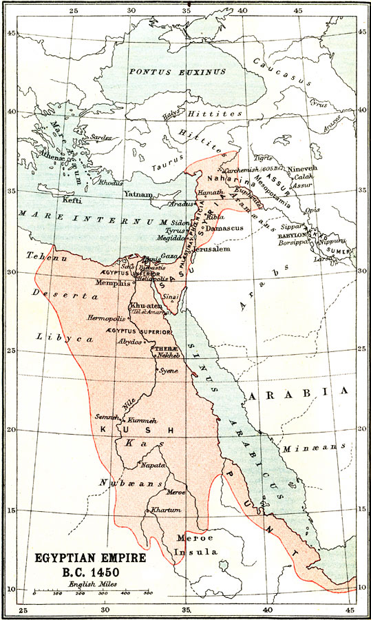
Description: A map of the Egyptian territory during the 18th Dynasty under Thothmes III (1480-1430 BC) along the Nile from Meroe Insula, north along the eastern Mediterranean coast into Syria and Naharina, and south along Red Sea into Punt. The map shows the major cities of the time, important rivers, areas under control of various groups such as the Hittites, Aramæans, Arabs, Minæans, and Nubæans, and the territories of Palestina, Phoenicia, Mesopotamia, Assur, Akkad, and Sumer. The map also shows the important battle sites of Megiddo and Carchemish.
Place Names: Egypt, Egypt, �Arabia, �Syri
ISO Topic Categories: society
Keywords: Egyptian Empire, political, �historical, society, Unknown, 1450 BC
Source: Ernest Rhys, Ed., A Literary and Historical Atlas of Asia (New York, NY: E.P. Dutton & CO., 1912) 4
Map Credit: Courtesy the private collection of Roy Winkelman |
|