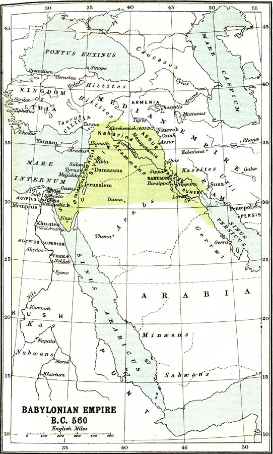
Description: A map of the Babylonian Empire during the Neo–Babylonian or Chaldean Era, circa 560 BC. This map shows the empire extending from Sumer and Akkad on the Persian Gulf, through Mesopotamia and Naharina, then west and south through Syria, Phoenicia, Palestina, and Sasu on the Sinai Peninsula. Place names are shown by their classical name forms. The map shows important cities of the period, ports, rivers, and territories of kingdoms and dependencies, both within the Babylonian Empire and neighboring lands. The map shows the Median Wall between Opis and Sippar near Babylon, and the earlier battle sites of Megiddo and Carchemish where the Egyptian army under Pharaoh Necho II was defeated by the Babylonians under Nebuchadnezzar II in 605 BC.
Place Names: Southwest Asia, Arabia, �Syria, �Babylon, �Sippa, �Damascus, �Jerusalem, �Mesopotami
ISO Topic Categories: society
Keywords: Babylonian Empire, political, �historical, country borders, society, Unknown, 560 BC
Source: Ernest Rhys, Ed., A Literary and Historical Atlas of Asia (New York, NY: E.P. Dutton & CO., 1912) 5
Map Credit: Courtesy the private collection of Roy Winkelman |
|