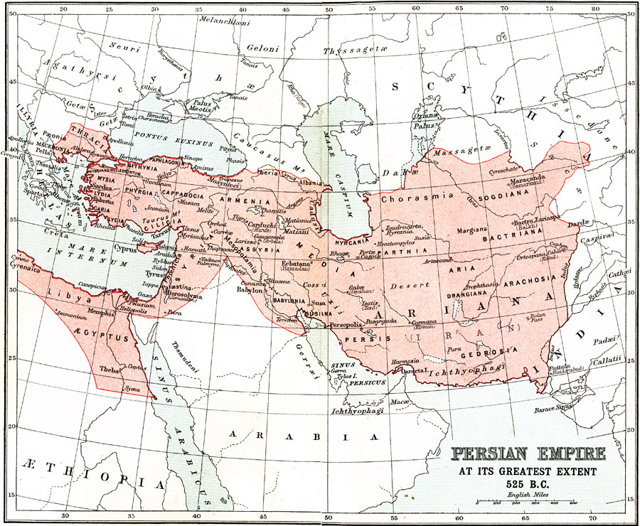
Description: A map of Persia at the time of Cyrus the Great, showing the greatest extent of the Persian Empire in 525 BC. The map shows the empire extending from Thrace in Europe and the North African coast across Asia to the Indus River. Territories within the empire are shown, as well as historically significant cities, rivers, and battle sites of the period.
Place Names: Southwest Asia, Media, �Ariana, �Babylonia, �Armenia, �Syria, �Libya, �Persis, �Sogdian
ISO Topic Categories: society
Keywords: The Persian Empire at Its Zenith, historical, �political, society, Unknown, 525 BC
Source: Ernest Rhys, Ed., A Literary and Historical Atlas of Asia (New York, NY: E.P. Dutton & CO., 1912) 6
Map Credit: Courtesy the private collection of Roy Winkelman |
|
