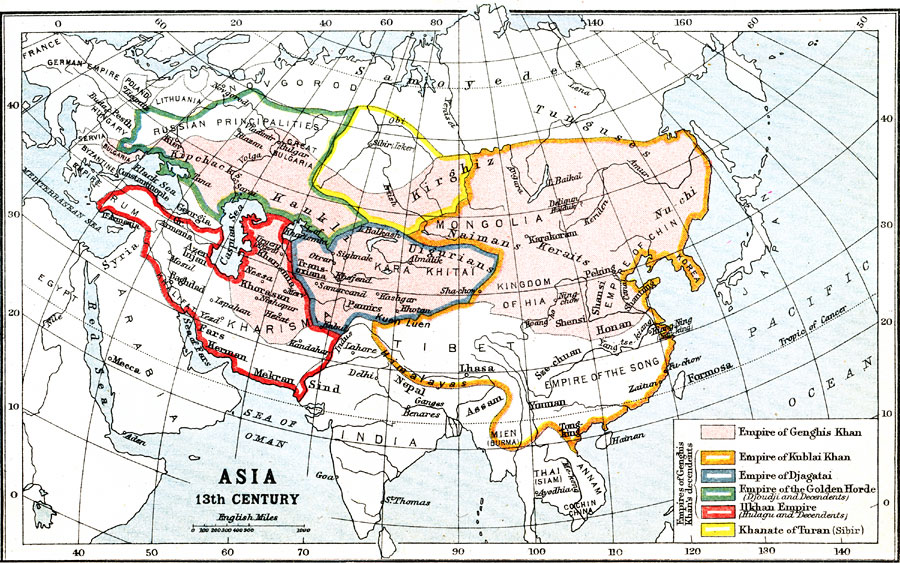
Description: A map of Asia showing the Empire of Genghis Khan (1206-1227) and the subsequent expansions by his descendants during the 13th century. The map is color-coded to show the territory under the control of Genghis Khan, the expansion in the east of his grandson Kublai Khan (1260-1294), the Empire of Djagatai (Chagatai), the Empire of the Golden Horde (Djoudji and descendents), the expansion into Persia of the Ilkhan Empire, and the Khanate of Turan (Sibir).
Place Names: A Complete Map of Asia, Tibet, �India, �Mongolia, �Arabia, �Kharismi
ISO Topic Categories: society
Keywords: The Empire of Genghis Khan in Asia, political, �historical, society, Unknown, 13th Century
Source: Ernest Rhys, Ed., A Literary and Historical Atlas of Asia (New York, NY: E.P. Dutton & CO., 1912) 16
Map Credit: Courtesy the private collection of Roy Winkelman |
|