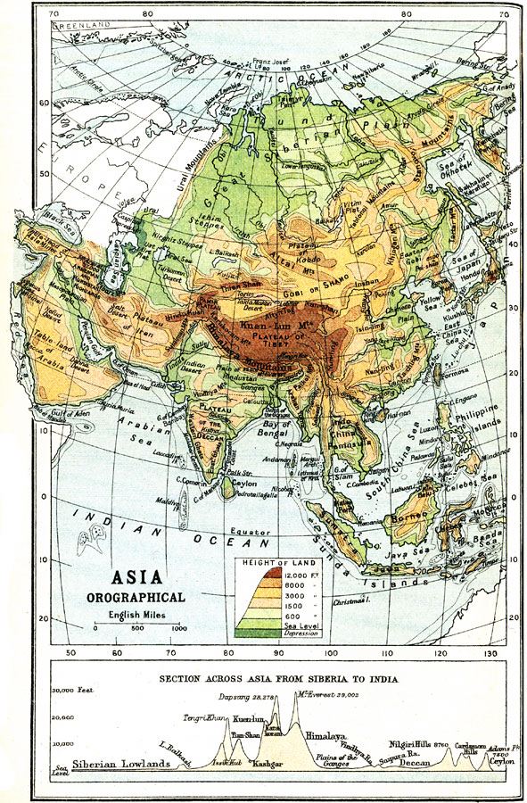
Description: An orographic map of Asia from 1912 showing average elevations and land features of the region. The map uses color-contouring to show land elevations from depressions below sea level to above 12,000 feet. Offshore fathom contour lines are given to indicate the margins of the submerged continental plateau. The map shows mountain systems, plateaus, plains, deserts, rivers, lakes, terrain and coastal features, and island. A chart at the bottom of the map shows a north–south cross-section of Asia from the Arctic Ocean in Siberia to India and Ceylon (Sri Lanka). The chart shows the typical profile of the Siberian Lowlands, Himalaya Mountains, Plains of the Ganges, and Deccan Plateau in feet above sea level. Several prominent mountain peaks are shown.
Place Names: A Complete Map of Asia, Russia, �Philippines, �Pakistan, �Mongolia, �Kazakhstan, �Japan, �Indonesia, �India, �China, �Thailan
ISO Topic Categories: elevation
Keywords: Elevations of the Asian Continent, physical, physical features,
topographical, elevation, Unknown, 1912
Source: Ernest Rhys, Ed., A Literary and Historical Atlas of Asia (New York, NY: E.P. Dutton & CO., 1912) 28
Map Credit: Courtesy the private collection of Roy Winkelman |
|