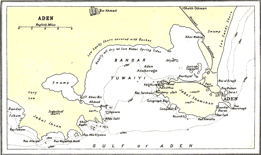
Description: A map from 1912 of the area around Aden, Yemen. The Gulf of Aden is one of the world's largest natural harbors and is what gives the city of Aden its vitality. Aden is situated in Yemen on the southwestern portion of the Arabian Peninsula between the southern end of the Red Sea and the Arabian Sea (Indian Ocean). The map shows Aden and nearby Bir Ahmad, the ancient aqueduct, and the piers, hotel, and road between Aden and the port area. This map shows water depths given in fathoms, descriptions of shore conditions, including vegetation cover, swamp land, and spring–tide lines.
Place Names: Yemen, Ade
ISO Topic Categories: society
Keywords: Aden, physical, physical features, society, Unknown, 1912
Source: Ernest Rhys, Ed., A Literary and Historical Atlas of Asia (New York, NY: E.P. Dutton & CO., 1912) 49
Map Credit: Courtesy the private collection of Roy Winkelman |
|