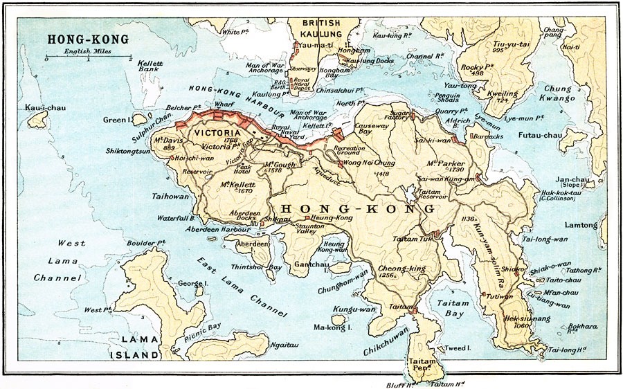
Description: A map from 1912 of the British colony on Hong Kong Island. Hong Kong was ceded to the British from the Qing Dynasty of China in 1842 under the Treaty of Nanking. The map shows the Hong Kong Harbor and Man of War anchorage around the city of Victoria, British Kaulung (Kowloon Peninsula), the northern portion of Lama Island, mountains and terrain, water depths, and coastal features of the island.
Place Names: China, Hong Kon
ISO Topic Categories: society
Keywords: Hong-Kong Island, physical, �political, physical features,
topographical, society, Unknown, 1912
Source: Ernest Rhys, Ed., A Literary and Historical Atlas of Asia (New York, NY: E.P. Dutton & CO., 1912) 79
Map Credit: Courtesy the private collection of Roy Winkelman |
|