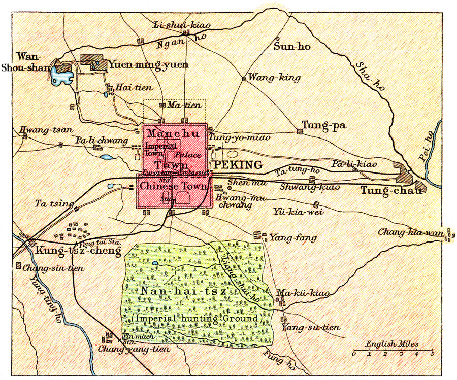
Description: A map from 1912 of the environs of Peking (Beijing) at the time. The map shows the Imperial Palace, the divisions of the Manchu Town, Imperial Town, and Chinese Town, the railways and major railway stations, the Nan–hai–tsz or Imperial Hunting Ground, the Yung&ndashting–ho, Pei–ho, and other rivers, and neighboring cities and towns, including Tung–chau, Yuen–ming–yuen, Kung–tsz–cheng, and others.
Place Names: China, Beijing, �Pekin
ISO Topic Categories: society,
transportation
Keywords: Peking, political, �physical, �transportation, roads,
railroads, society,
transportation, Unknown, 1912
Source: Ernest Rhys, Ed., A Literary and Historical Atlas of Asia (New York, NY: E.P. Dutton & CO., 1912) 86
Map Credit: Courtesy the private collection of Roy Winkelman |
|