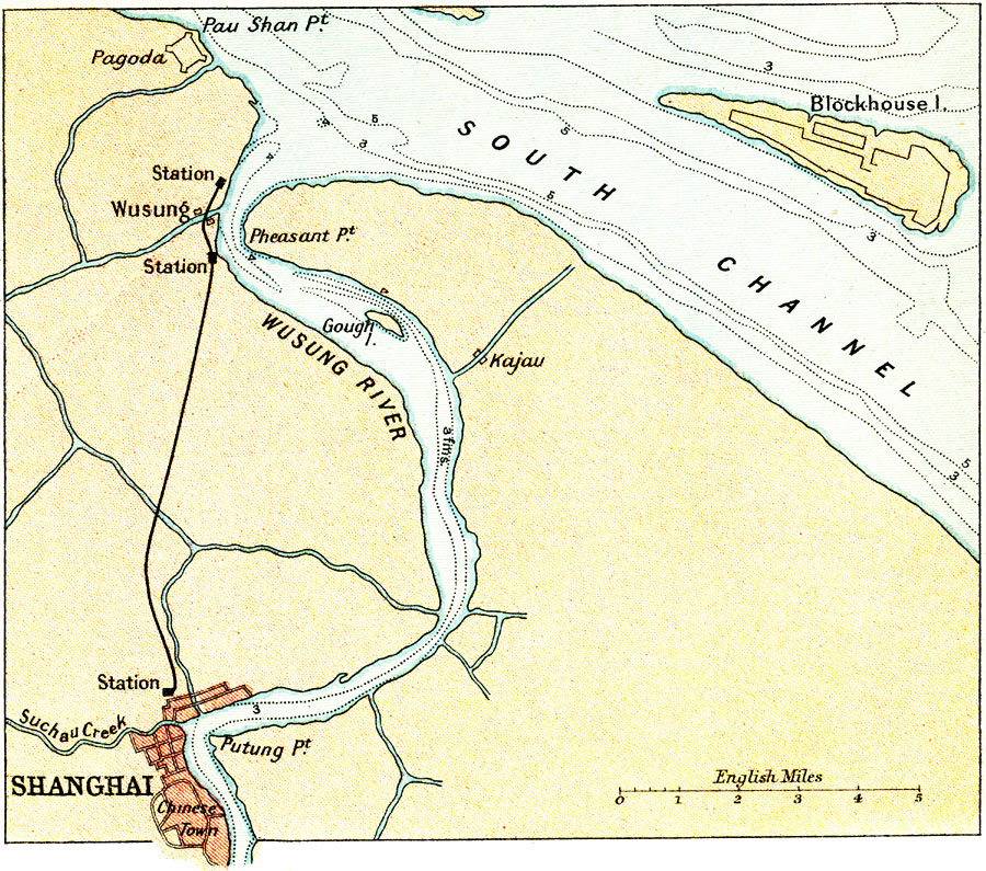
Description: A map from 1912 of the area around Shanghai, China. The Chinese city of Shanghai is of strategic importance for trading because of its location at the mouth of the Yangtze River, and was at this time a treaty port (open to foreign trade). This map shows the city's location at the confluence of the Suchau (Suzhu) Creek and Wusung (Huangpu) River, a tributary of the Yangtze, the south channel of the Yangtze, the railway and railway stations to the village of Wusung (Wusonkou), the pagoda near Pau Shan point, and the southern section of the city known as Chinese Town. Water depths of the Wusung and Yangtze are given in fathoms with contours indicating river channels.
Place Names: China, Shangha
ISO Topic Categories: society
Keywords: Shanghai and Environs, political, �transportation, railroads, society, Unknown, 1912
Source: Ernest Rhys, Ed., A Literary and Historical Atlas of Asia (New York, NY: E.P. Dutton & CO., 1912) 86
Map Credit: Courtesy the private collection of Roy Winkelman |
|