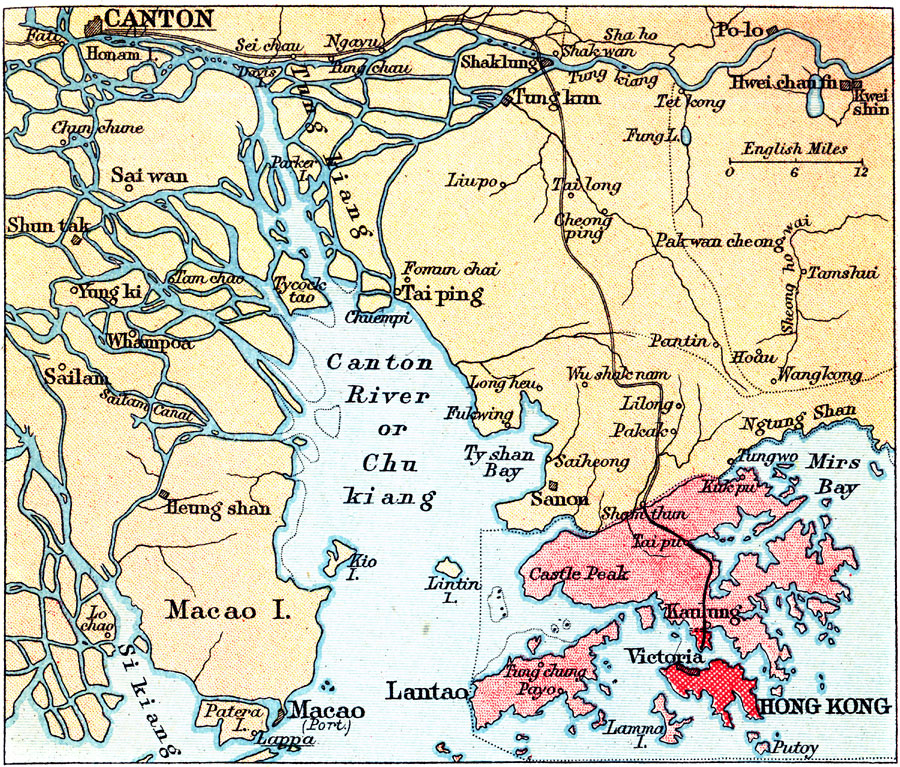
Description: A map from 1912 of the Pearl River delta from Canton (Guangzhou) to Hong Kong and Macao on the China Sea. At this time, Hong Kong was a possession of Great Britain, and Macao was officially a Portuguese colony. This map shows the river courses of the Chu Kiang (Pearl River or Zhujiang), Si Kiang (West River or Xijiang), and Tung Kiang (East River or Beijiang) through the delta, coastal features, railroads, and the cities of the area. The territory composed of more than 260 islands known as Hong Kong was ceded from the Qing Dynasty of China in 1842 under the Treaty of Nanking.
Place Names: China, Hong Kon
ISO Topic Categories: society
Keywords: Hong Kong, political, �physical, �transportation, major political subdivisions, society, Unknown, 1912
Source: Ernest Rhys, Ed., A Literary and Historical Atlas of Asia (New York, NY: E.P. Dutton & CO., 1912) 87
Map Credit: Courtesy the private collection of Roy Winkelman |
|