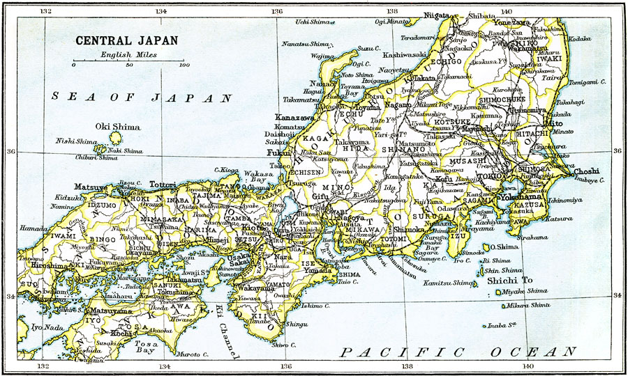
Description: A map from 1912 of the central portion of Japan, from Yonezawa in the north to Hiroshima in the south on the main island of Honshu. The map also shows the island of Nanka (Shikoku). The map shows the prefectures at the time, major cities and towns (including Tokio, Yokohama, Osaka, and Kioto), railways, rivers, islands, and coastal features of the area.
Place Names: Japan, Osaka, �Yokohama, �Hiroshim
ISO Topic Categories: society,
transportation
Keywords: Central Japan, political, �physical, �transportation, physical features, railroads, society,
transportation, Unknown, 1912
Source: Ernest Rhys, Ed., A Literary and Historical Atlas of Asia (New York, NY: E.P. Dutton & CO., 1912) 91
Map Credit: Courtesy the private collection of Roy Winkelman |
|