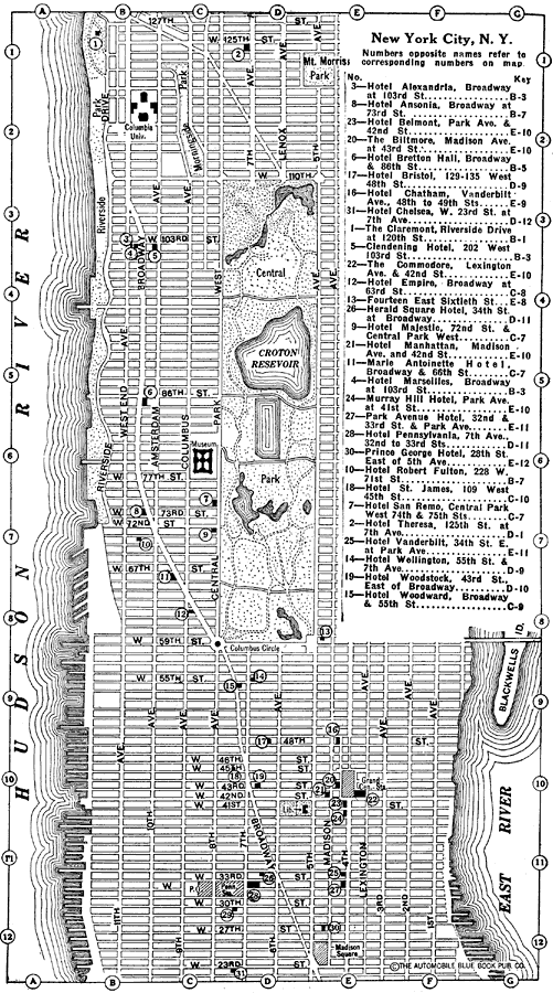
Description: A map of New York City from the 1920 Automobile Club of Rochester, showing the location of various hotels in the down–town area.
Place Names: New York, New York City, �Central Park, �Hudson River, �East River,
ISO Topic Categories: location,
inlandWaters,
structure,
transportation
Keywords: Where to Stop in New York, physical, �transportation, physical features, roads, location,
inlandWaters,
structure,
transportation, Unknown,1920
Source: , Automobile Club of Rochester (New York, NY: The Automobile Club of Rochester, 1920) 218
Map Credit: Courtesy the private collection of Roy Winkelman |
|