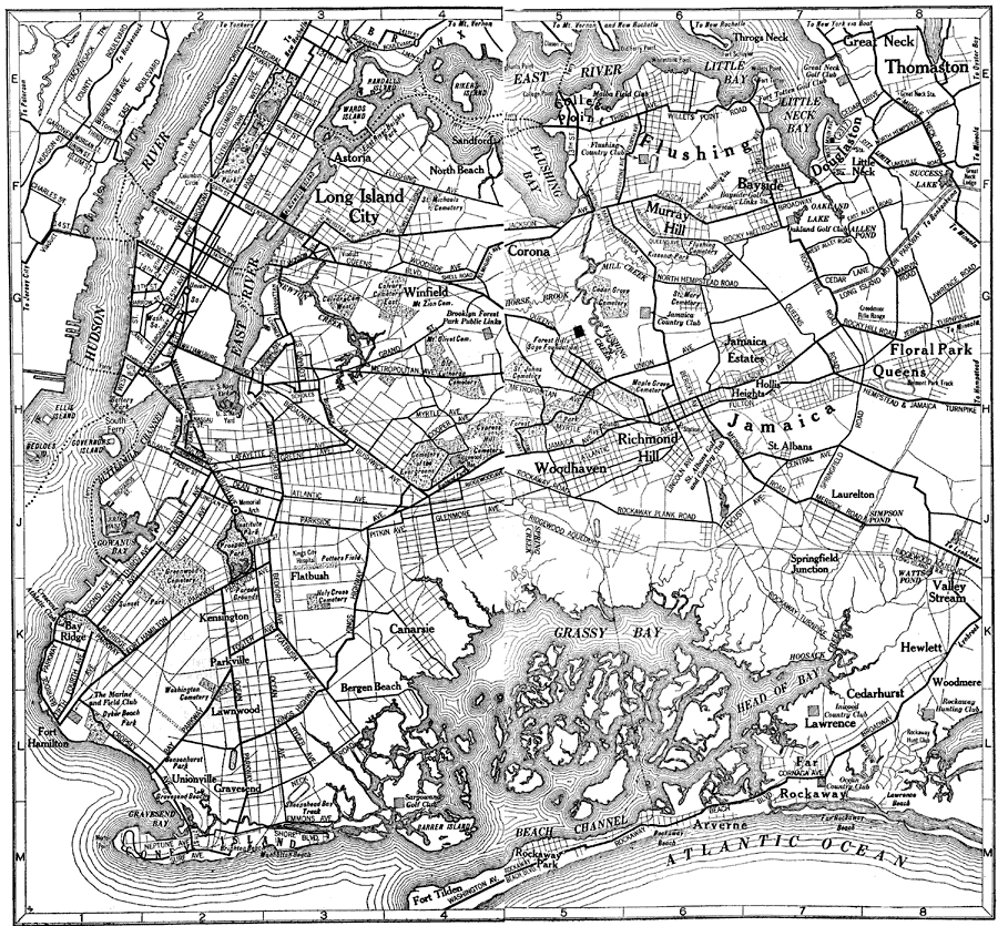
Description: A road map of Brooklyn and Queens, New York, from the 1920 Automobile Club of Rochester, showing the Hudson River, East River, principal roads, railroads, Bridges, ferry routes, and major landmarks.
Place Names: New York, Brooklyn, �Queens, �Jamaica, �Thomaston, �Grassy Bay, �Long Island, �Flushing, �Douglaston, �Hudson River, �East River,
ISO Topic Categories: location,
inlandWaters,
transportation
Keywords: Brooklyn and Queens, physical, �transportation, kAutomobile, physical features, roads,
railroads, location,
inlandWaters,
transportation, Unknown,1920
Source: , Automobile Club of Rochester (New York, NY: The Automobile Club of Rochester, 1920) 246-247
Map Credit: Courtesy the private collection of Roy Winkelman |
|