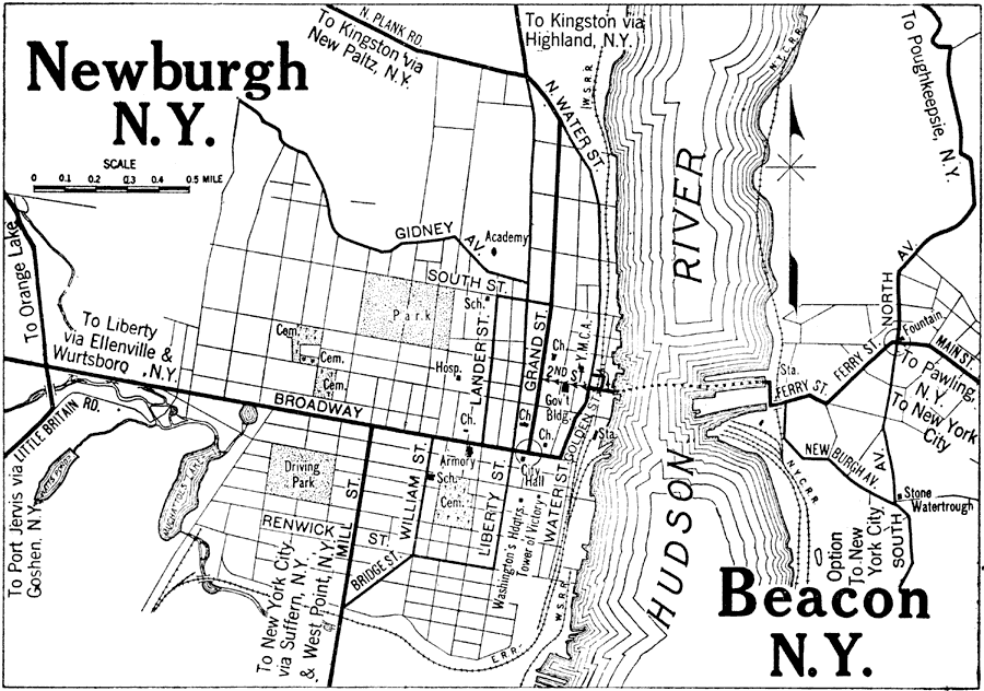
Description: A road map of Newburgh and Beacon, New York, from the 1920 Automobile Club of Rochester, showing the Hudson River, principal roads, railroads and stations, ferry routes, and major landmarks.
Place Names: New York, Beacon, �Hudson River,
ISO Topic Categories: inlandWaters,
location,
structure,
transportation
Keywords: Newburgh and Beacon, New York., physical, �transportation, kAutomobile, physical features, roads,
railroads, inlandWaters,
location,
structure,
transportation, Unknown,1920
Source: , Automobile Club of Rochester (New York, NY: The Automobile Club of Rochester, 1920) 318
Map Credit: Courtesy the private collection of Roy Winkelman |
|