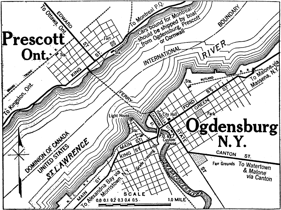
Description: A map from the 1920 Automobile Club of Prescott, Ontario and Ogdensburg, New York, along St. Lawrence River. This map shows major streets, railroad stations, the lighthouse, International Border, and the ferry crossing across the St. Lawrence.
Place Names: A Regional Map of North America, Canada, �United States, �Prescott, �Ogdensburg, �St. Lawrence River, �Oswegatchie River,
ISO Topic Categories: location,
inlandWaters,
boundaries,
transportation
Keywords: Prescott, Ontario and Ogdensburg, New York, physical, �political, �transportation, physical features, country borders, roads,
railroads, location,
inlandWaters,
boundaries,
transportation, Unknown,1920
Source: , Automobile Club of Rochester (New York, NY: The Automobile Club of Rochester, 1920) 540
Map Credit: Courtesy the private collection of Roy Winkelman |
|
