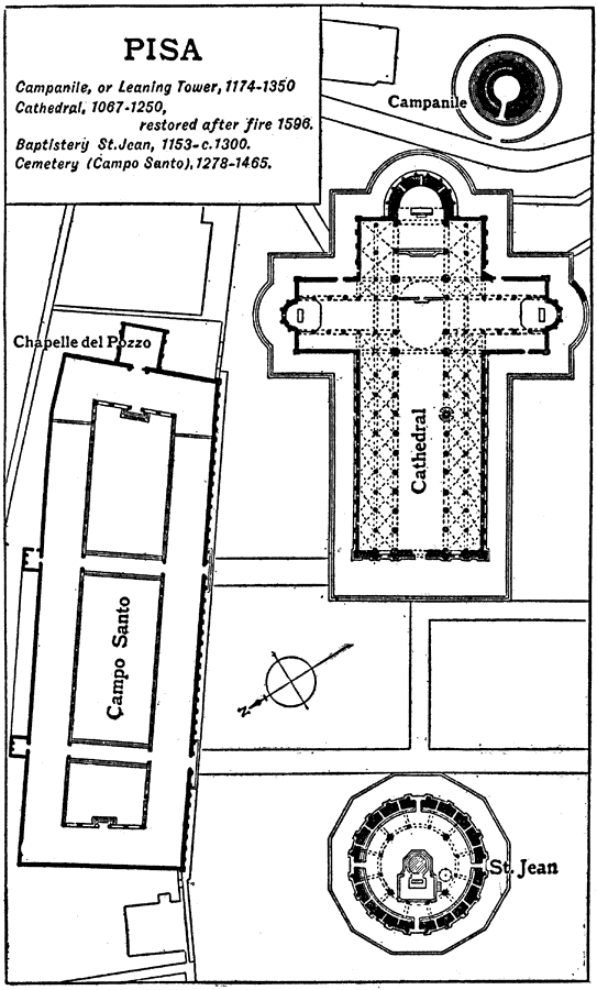
Description: This is the plan of the Campanile and Cathedral in Pisa, Italy. This is an example of Italian Central Romanesque architecture. Furthermore it is an example of a Pisan Church. The Campanile, or Leaning Tower was erected from 1174 to 1350. The Cathedral was erected in 1067 to 1250 and restored after a fire in 1596. The Baptistery of St. Jean was erected in 1153 to 13th Century AD. The Cemetery, Campo Santo, was erected in 1278 to 1465.
Place Names: Italy, Pis
ISO Topic Categories: structure
Keywords: Plan of the Campanile de Pisa, historical, �architecture, kArchitecture, structure, Unknown, 1068–1509
Source: , The Enctclopædia Britannica a Dictionary of Arts, Sciences, Literature and General Information Eleventh Edition Volume II Andros to Austria (New York, NY: The Encyclopædia Britannica Company, 1910) 394
Map Credit: Courtesy the private collection of Roy Winkelman |
|