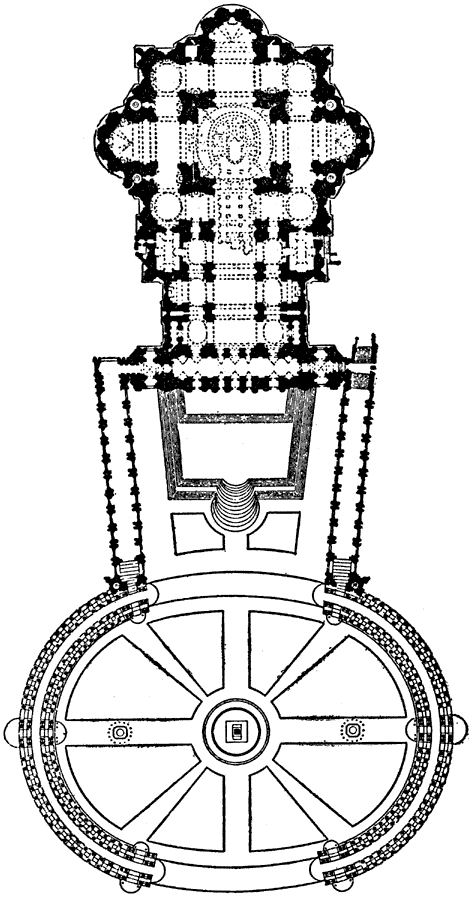
Description: This is a plan of the St Peter's at Rome. It is an example of Italian Renaissance architecture. The construction lasted from 1546 to 1564AD. "In 1505, on the advise of Michelangelo, Bramante was instructed to prepare designs for a new church in Rome dedicated to St Peter, to take the place of the early basilica, which, built in haste, began to show serious signs of failure [...] In 1546 Michelangelo, then seventy–two years of age, was entrusted with the continuance of the work, and he made radical changes, chiefly in the design of the dome. "
Place Names: Italy, Plan of St Peter's at Rom
ISO Topic Categories: structure
Keywords: Plan of St Peter's at Rome, architecture, kArchitecture, structure, Unknown, 1546–1564
Source: , The Enctclopædia Britannica a Dictionary of Arts, Sciences, Literature and General Information Eleventh Edition Volume II Andros to Austria (New York, NY: The Encyclopædia Britannica Company, 1910) 410
Map Credit: Courtesy the private collection of Roy Winkelman |
|