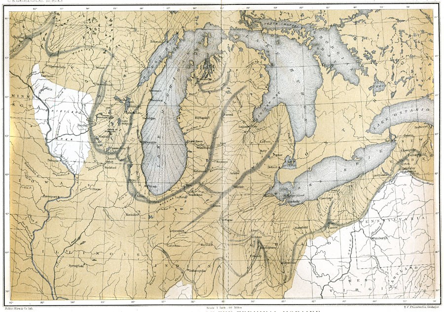
Description: A map of the terminal moraine of the second glacial epoch in the Great Lakes region, including the drift bearing area, the generalized directions of glacial movement, the direction of glacial striae, and the locations of prominent terminal moraines. Map scale is one inch equals 60 miles, and referenced to Julius Bien and Co. lith.
Place Names: A Regional Map of North America, Canada, �United States, �Minnesota, �Wiscinsin, �Illinois, �Michigan, �Indiana, �Ohio,� Pennsylvania, �New York, �Saginaw Bay, �Lake Michigan, �Lake Erie, �Madison, �Chicago,
ISO Topic Categories: geoscientificInformation,
inlandWaters
Keywords: The Terminal Moraine (Central), physical, �political, �Driftless Area, kGeology, kGlacial, physical features, country borders,
major political subdivisions, geoscientificInformation,
inlandWaters, Unknown, Second Glacial Epoch
Source: Thomas C. Chamberlin, United States Geological Survey Annual Report, 3rd (Washington, DC: United States Geological Survey, 1882) PL.XXXI
Map Credit: Courtesy the private collection of Roy Winkelman |
|