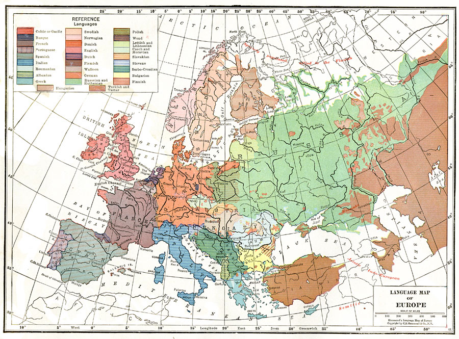
Description: This map shows the divisions of language usage in World War I era Europe. Many of these languages fall into the Indo–European language family, the largest language family in the world. This family includes German, Greek, Italian, English, French, and Russian. Separation of nations by language is evident in the map. In such places as the Austria–Hungary Empire, which would dissolve after World War I, we can see future divisions. The future Czech Republic, which has a different language than the surrounding area, would eventually form its own nation in 1993.
Place Names: A Complete Map of Europe, France, �Germany, �Greece, �Italy, �Poland, �Portugal, �Romania, �Spain, �Sweden, �United Kingdom, �Turkey, �Netherlands, �Belgium, �Austria, �Hungary, �Serbia, �Yugoslavia, �Bulgaria, �Albania, �Montenegro, �Cyprus, �Russia, �Switzerland, �Czech Repub
ISO Topic Categories: boundaries,
inlandWaters,
society
Keywords: Language Map of Europe, physical, �political, �historical, �language, kLanguage, physical features, country borders, WWI, boundaries,
inlandWaters,
society, Unknown, 1914–1918
Source: , The Victory Atlas of the War (New York, NY: Charles Scribner's Sons, 1918) 2
Map Credit: Courtesy the private collection of Roy Winkelman |
|